


Morne modeste-piton lacroix

Vincent Galva
User
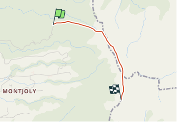

Length
2.4 km

Max alt
1180 m

Uphill gradient
716 m
Km-Effort
9.9 km

Min alt
562 m

Downhill gradient
115 m
Boucle
No
Creation date :
2021-09-02 03:27:20.363
Updated on :
2021-09-02 03:27:23.411
4h30
Difficulty : Very difficult

FREE GPS app for hiking
 SityTrail
IGN / Geographical institutes
SityTrail Plus
The world is yours!
About
Trail Walking of 2.4 km to be discovered at Martinique, Unknown, Le Morne-Vert. This trail is proposed by Vincent Galva.
Positioning
Country:
France
Region :
Martinique
Department/Province :
Unknown
Municipality :
Le Morne-Vert
Location:
Unknown
Start:(Dec)
Start:(UTM)
701833 ; 1627249 (20P) N.
Comments